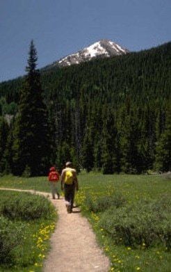
Hiking
Hiking in the Lake Almanor Basin
With miles of shoreline trails and forested logging roads, the Lake Almanor Basin is a hiker’s paradise. The Basin is also close to magnificent hikes within Lassen Volcanic National Park and the nearby Caribou Wilderness Area in the Lassen National Forest. Following are some of the most popular hikes in this and surrounding areas.
Additional Information
Additional hiking and biking information for the Lake Almanor Basin, Lassen Forest and Caribou Wilderness and Lassen Volcanic National Park can be found in guide books at B & B Booksellers, Bodfish Bicycles, and at the Lassen Association Bookstore at Lassen Volcanic National Park.
Hiking in the Lake Almanor Basin
Lake Almanor Recreation Trail
Length:11 miles
Effort:Easy
Hike Time: About 3 hours one-way
This paved, barrier free, non-motorized trail follows the west shore of the lake, offering numerous scenic vistas and interpretive sites.The southern trailhead is at the Canyon Dam Boat Launch, off Highway 89.To reach the northern access, turn northeast on the unpaved road opposite Humbug road turnoff on Highway 89.The trailhead is less than a quarter mile down before the archery range.This trail also is open to bicyclists and cross-county skiers.
Humbug Summit to Humboldt Peak
Length: 6 Miles
Effort: Easy
Hike Time: About 2 hours one way
The trailhead for this slightly uphill hike is located about 19 miles off Highway 89 (west shore) on Humbug Road.After leaving the highway, continue straight at the intersections to stay on Humbug Road.The road is a bit rough, but passable in a two-wheel drive vehicle.Parking and the trailhead is past Humbug Summit at Cold Spring, a fresh water spring.This leg of the Pacific Crest Trail has spectacular views.
Juniper Lake/Mt. Harkness Trail
Length:5.5 miles
Effort:Difficult
Hike Time:3.5 hours round trip
This loop trail lies just inside Lassen Volcanic National Park.Follow Feather River Drive northwest of Chester and take the right fork 11 miles to the Juniper Lake campground.The trail climbs to 8,000 fee and offers dramatic views of remote park beauty.
Domingo Springs Trail
Length:7 miles
Effort:Moderate
Hike Time:Over 2 hours one way
The trail head is located off of Feather River Drive northwest of Chester just past Domingo Springs Campground.Ice cold water is available from a faucet at the springs which are surrounded by lush ferns and watercress.The hike goes into Lassen Volcanic National Park.
Devil's Kitchen
Length: 1.7 miles
Effort:Easy
Hike Time: 45 minutes one way.
Hydro thermal site. Trail head located in Lassen Volcanic National Park at Drakesbad Guest Ranch.
Boiling Spring Lake
Length: 1.0 mile
Effort: Moderate
Hike Time: 25 minutes one way
Largest Boiling acid lake in the USA. Trail head located in Lassen Volcanic National Park at Drakesbad Guest Ranch.
King Creek Cascades and Fall
Length: 2.25 miles,
Effort: Challenging
Hike Time: 1.45 hours.
Trail head located in Lassen Volcanic National Park at Drakesbad Guest Ranch.
Pacific Crest Trail
Zigzagging its way from Mexico to Canada through California, Oregon and Washington the Pacific Crest Trail (PCT) boasts the greatest elevation changes of any of America's National Scenic Trails, allowing it to pass through six out of seven of North America's ecozones including high and low desert, old-growth forest and arctic-alpine country.The Trail crosses Highway 89 and traverses Lassen Volcanic National Park, overseen by Lassen Peak (elev. 10,457'). North of the park the PCT follows the mostly water-less Hat Creek Rim toward majestic Mt. Shasta, which dominates the north-state skyline.For more information about the trail visit the Pacific Crest Trail website.